Enjoy the idyllic landscape
Hiking on the Wallberg


Enjoy the idyllic landscape
Hiking on the Wallberg
Many attractive hiking trails start at the mountain station of the Wallbergbahn. Whether you prefer a walk to the Wallberg-Kircherl, the 100-year-old landmark high above the Tegernsee valley, or are planning a more challenging tour to the Risserkogel or Setzberg, you will enjoy the sensational view either way.
Off to one of the most beautiful summit crosses in the Bavarian Alps


Off to one of the most beautiful summit crosses in the Bavarian Alps
The summit of the Wallberg
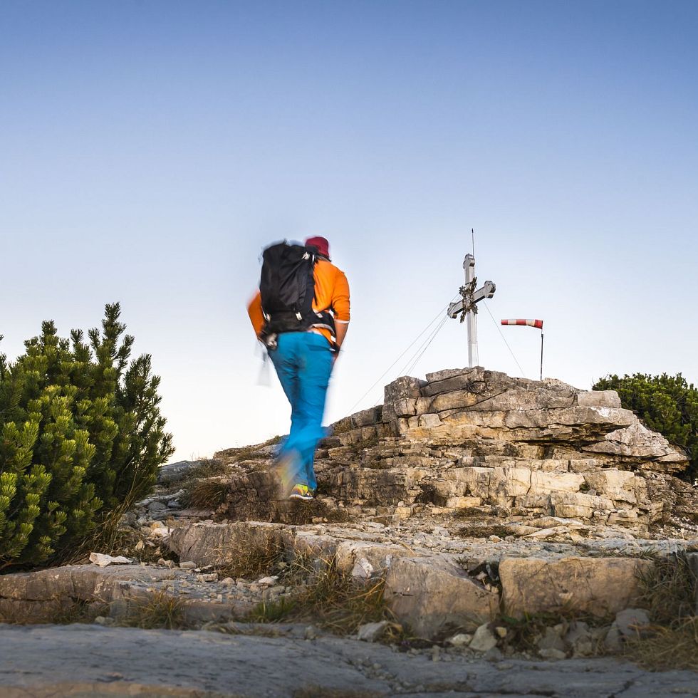
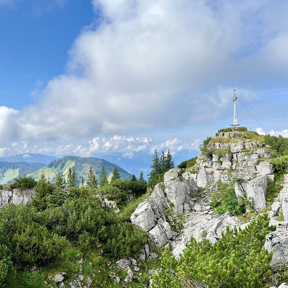
Without exaggeration, the summit of the Wallberg is adorned with one of the most beautiful summit crosses in the Bavarian Alps. And although the view of Lake Tegernsee and the surrounding mountains from the Wallberg plateau is already breathtaking, the 30-minute climb from the top station of the Wallbergbahn cable car is worthwhile for anyone who doesn't want to miss out on a real summit experience. The path to the summit leads past the panorama restaurant on the right, first into a small depression and then steeply up to a saddle. From there, the trail climbs up to a plateau via a number of scree slopes that require sturdy footwear and surefootedness. There you can see the rocky summit of the Wallberg with its beautiful summit cross.
Renewal of the Alpine nature trail


Renewal of the Alpine nature trail
The route of the Alpine nature trail
The Alpine nature trail from the accommodation building on the Wallberg via the Setzberg to the Risserkogel had been renewed in 2023. As part of the joint project between the municipalities of Kreuth and Rottach-Egern, the Wallbergbahn and the Bavarian State Forests, which was partly funded by the Free State, 18 new information boards were purchased. The newly designed information boards introduce visitors to the respectful treatment of nature and wildlife, the formation of the Alps, information on the mountain forest, the importance of alpine pasture management, hunting in the high mountains and animals such as chamois and golden eagles.
Hikers need around two and a half hours to complete the four-kilometre educational trail. 600 meters of altitude difference have to be conquered in total. Due to its length and constitution the tour is ranked as moderately diffcult.
Experience chamois - chamois observation station


Experience chamois - chamois observation station
Life in the mountains
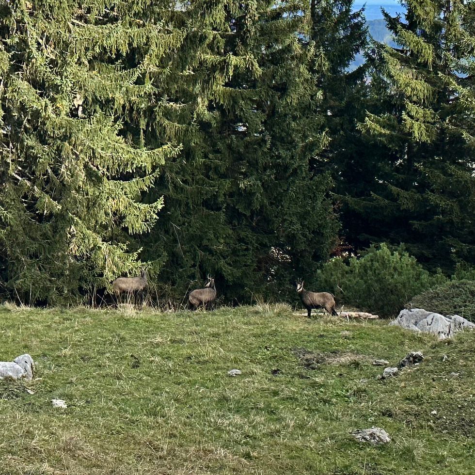
In the middle of the approximately four-kilometre-long and 300-metre-high route through the Natura 2000 conservation area is the chamois observation station with a small shelter and a permanently installed telescope.
If you are quiet and considerate, you may - with a bit of luck - gain valuable insights into the life and climbing skills of the chamois or even spot a marmot or golden eagle. The aim is to make it possible for hikers to experience these diurnal animals. The observation point offers a view of the Risserkogel, where chamois spend the summer rearing their fawns, among other things.
Hiking with the Wallbergbahn
Please only start with suitable footwear and good equipment. The times given are guidelines; the walking time may vary depending on your personal walking speed.
Path to the mountain station (1620 m)
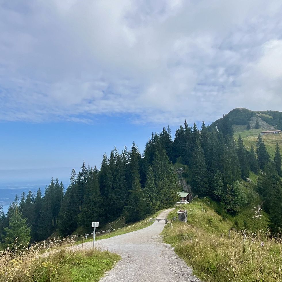
Start to the right of the valley station on a wide forest path following the yellow signs towards "Wallbergbahn Bergstation" (No. 618). After approx. 20 minutes the path divides. Keep left here and continue along the somewhat steeper gravel path (no. 618) towards Wallbergsattel. Once at the Wallbergsattel, you can reach the Alte Wallberghaus (1512 m) within five minutes by turning right. For the direct route (no. 618) to the mountain station of the Wallbergbahn, turn left, continue along the wide road, which is part of the toboggan run in winter, and finally reach the panorama restaurant, which is open all year round. From there you can enjoy an impressive panoramic view from the foothills of the Alps to the Zugspitze and the Großglockner and Großvenediger. The Wallbergbahn then takes you back down to the valley in about 15 minutes. During the ride, you can enjoy the last magnificent views of Lake Tegernsee and the picturesque surrounding countryside.
Path to the mountain station (1620 m)
Here you start again to the right of the valley station on the wide forest path (no. 618) and this time keep right at the junction (no. 618a). This will take you to the Wallbergmoosalm in just under an hour on the slightly longer, but not so steep hiking trail. After this, the path soon becomes steeper as it winds up a wooded slope. Sure-footedness and good footwear are required, as this steep and rooted path can be very slippery in places when it rains. About an hour from the Wallbergmoosalm, you will rejoin trail no. 618 and reach the mountain station via the Wallbergsattel.
Path to the Wallberg-Kircherl (1605m)
(approx. 5 minutes, easy hike, trail no. 618)
From the mountain station, it is only a few steps to the Wallberg Chapel, the 100-year-old landmark of the Wallberg. Even this short walk offers magnificent views down into the valley and around to the Tegernsee mountains. In summer, regular church services are held in the Wallberg-Kircherl. This hill also offers an unrestricted view of one of the two paragliding take-off sites, inviting you to linger and watch.
Path from the mountain station to the Wallberg summit (1722 m)
Enjoy a leisurely ride on the Wallbergbahn to the mountain station and start your hike by walking east under the cable car. First you walk uphill for a few minutes on a wide path (no. 618), past a mountain guard hut and finally pass one of the two paraglider launch sites on the Wallberg in front of the Hintermaueralm. Here you can watch the take-off preparations and the take-off towards Tegernsee at close range - but for your own safety, make sure you keep a safe distance so as not to obstruct the paragliders as they take off.
Continue your hike along the partly rocky path, which eventually climbs steeply to a saddle. From there, the trail climbs up to a plateau via a few rocky sections that require sturdy footwear and surefootedness. There you can see the rocky summit of the Wallberg with its imposing summit cross.
Path from the mountain station on the Alpine nature trail
(approx. 1.5 hours, easy hike, trail no. 618b, 617)
From the mountain station of the Wallbergbahn cable car, head west downhill and follow the signs for Setzberg/Risserkogel (No. 618b, 617). Here you can hike along the forest road past the Wallberg-Kircherl in the direction of the Altes Wallberghaus. The chamois symbol on the yellow signposts will help you find your way. At the Altes Wallberghaus, you can follow the path to the left towards Risserkogel (no. 618b, 617) or opt for the ascent to Setzberg. If you choose the latter, descend from the Setzberg summit via the eastern flank. This path is not signposted but is clearly visible and initially leads steeply downhill on a moderately difficult section, which can be very slippery after rainfall and requires good footwear and surefootedness! Both paths meet again after approx. 45 minutes. The following trail (no. 618b then 617) leads through old spruce forests and offers plenty of variety thanks to the Alpine nature trail. On over 30 boards, you will learn interesting facts about the forest, game, climate and geology of the Bavarian Alps as well as the management of the mountain forests and alpine farming. Another special feature of this hike is the "GAMS ERLEBEN" observation point. Here you can find out more about chamois, a fascinating inhabitant of the mountains and, with a bit of luck, observe the animals foraging against the backdrop of the Risserkogel and Blankenstein. An impressive experience for children!
Path from the mountain station to the Setzberg (1706 m)
From the mountain station of the Wallbergbahn cable car, head west downhill and follow the signs for Setzberg/Risserkogel (No. 618b, 617). The forest road leads past the Wallberg-Kircherl and one of the two paraglider launch sites on the Wallberg. Here, below the path, you can watch the launch preparations and the take-off towards Tegernsee at close range.
Continue your hike in the direction of the Altes Wallberghaus, behind which an earthy path winds its way up to the ridge. There the path leads to the summit with its large wooden cross. You can walk back the same way or descend towards the eastern flank of the Setzberg. This path is not signposted but is clearly visible and initially leads steeply downhill, which can be very slippery after rainfall and requires good footwear and surefootedness! Keep left at the "Setzberg-Alpenlehrpfad" junction and hike back towards the mountain station via the Alte Wallberghaus.
Path from the mountain station to the Risserkogel (1826 m)
You first hike as described under "Trail from the mountain station on the Alpine nature trail to the GAMS ERLEBENobservation point" and then continue on the Alpine nature trail towards Grubereck/Risserkogel (no. 618b, 617). The forest path winds its way over many tree roots through old spruce forests and repeatedly offers small views of the surrounding mountains. Shortly before the Grubereck, the Via Alpina (no. 617) crosses your path from the right coming from Kreuth, on which you continue to the Risserkogel summit. Once you reach the Grubereck (1664 m), you have a clear view in all directions for the first time. The ridge now turns to the east and initially widens, but then narrows into a slightly exposed ridge. This is followed by the most impressive part of this hike, the ascent over the rocky, airy Risserkogel Westkamm! Good hiking boots and surefootedness are required here! Shortly before the summit, wire rope safety devices help you to climb over the rocky path. Once you reach the top, a magnificent view of the fascinating mountain world opens up, with good visibility as far as the main Alpine ridge!
Path from the mountain station to the Risserkogel (1826 m)
Hike to the Risserkogel as described under "Trail from the mountain station to the Risserkogel (1826 m) via the Alpine nature trail and GAMS ERLEBENobservation point". For the way back, walk back a short distance on the ascent path until a steep path (no. 617, Via Alpina) branches off to the right in the direction of Blankenstein. In the hollow before the Blankenstein, turn right again, following the Via Alpina (no. 617). The further descent leads under the Risserkogel along the north-south face of the Blankenstein, past the Riedereckalm and via the Siblialm (No. 617) into the valley to the Hufnagelstube parking lot (opposite the Suttenbahn). A detour to the Sibli waterfalls is definitely worthwhile on this route, a natural spectacle in both summer and winter! From the parking lot of the Hufnagelstube, you walk further downhill to Enterrottach, where you can follow hiking trail no. 503 partly off the road. The short detour to the Rottachfall (signposted) is particularly recommended. After the Almhof in Enterrottach, the road crosses the Rottach. Keep left at the next junction (no. 504). In this way you circle the Wallberg at its foot until you reach the parking lot of the Wallbergbahn at the valley station at the Gasthof Alpenwildpark.
Circular trail from the mountain station to the Risserkogel (1826 m)
Hike to the Risserkogel as described under "Trail from the mountain station to the Risserkogel (1826 m) via the Alpine nature trail and GAMS ERLEBENobservation point". For the way back, walk back a short distance on the ascent path until a steep path (no. 617, Via Alpina) branches off to the right in the direction of Blankenstein. In the hollow before the Blankenstein, leave the Via Alpina on the left and descend towards Röthenstein lakes and Röthenstein-Alm (no. 617b). The path turns into a gravel road that leads into a tarred road. The path forks at the Rottach-Alm. Leave trail no. 617b keeping left and walk uphill past the Portneß-Alm until shortly before the Alte Wallberghaus. From there, continue right back to the mountain station of the Wallbergbahn.